
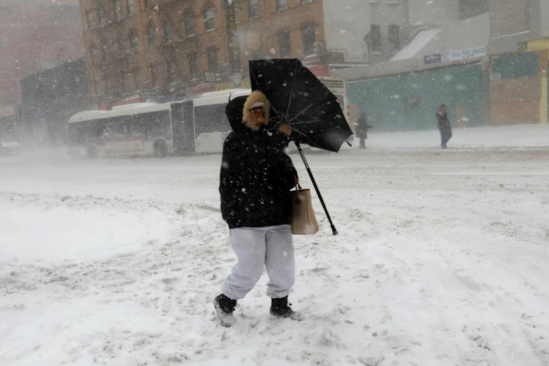

تستعد منطقة وسط المحيط الأطلسي وشمال شرق الولايات المتحدة لمواجهة واحدة من أقوى العواصف الشتوية في السنوات الأخيرة، إذ حذرت الهيئة الوطنية للأرصاد الجوية الأمريكية من اقتراب عاصفة «نور إيستر» القوية التي ستضرب المنطقة بدءاً من اليوم (الأحد)، وتستمر حتى الإثنين، محملة بكميات هائلة من الثلوج، رياح عاتية، وعواصف ثلجية تصل إلى حد «الأعاصير» في عدة مناطق.
وفقاً للتحديثات الصادرة عن مركز التنبؤ بالطقس، من المتوقع أن تتراكم الثلوج بين 30 و60 سم في العديد من المناطق، خصوصاً جنوب ولاية نيويورك، وكونيتيكت، وماساتشوستس، مع تساقط محلي أعلى في شرق بنسلفانيا ومناطق ساحل نيو إنجلاند.
وفي بعض المناطق الساحلية والقريبة من المحيط، قد تتجاوز كميات الثلج أكثر من 60 سم، مع معدلات تساقط تصل إلى 2-4 سم في الساعة أحياناً، مما يعزز فرص حدوث عواصف ثلجية كثيفة مع انخفاض الرؤية إلى أقل من ربع ميل بسبب الرياح والثلوج المتطايرة.
وتشير التحذيرات الرسمية إلى أن الرياح الشمالية الشرقية القوية ستتجاوز سرعتها 80-110 كم/ساعة في بعض النقاط الساحلية، مما يهدد بانقطاع التيار الكهربائي على نطاق واسع بسبب تراكم الثلوج الرطبة الثقيلة على الأشجار والأسلاك، إلى جانب فيضانات ساحلية متوسطة إلى شديدة خلال ارتفاع المد العالي على مدار اليومين القادمين.
وتوقعت السلطات الأمريكية أن يتأثر بهذه العاصفة نحو 100 مليون شخص من واشنطن العاصمة مروراً ببالتيمور وفيلادلفيا ونيويورك، وصولاً إلى بوسطن وأجزاء من نيو إنجلاند.
وقد أصدرت الهيئة الوطنية للأرصاد الجوية الأمريكية تحذيرات من عاصفة ثلجية شديدة في مناطق واسعة تشمل نيويورك ولونغ آيلاند وأجزاء من نيوجيرسي وديلاوير، إلى جانب تحذيرات من عاصفة شتوية تغطي معظم المنطقة.
وتعتبر العواصف الشمالية الشرقية ظاهرة شتوية شائعة على الساحل الشرقي للولايات المتحدة، تحدث عندما يتكون منخفض جوي قوي قبالة الساحل الأطلسي ويتحرك شمالاً، مما يجمع بين الهواء البارد القادم من الشمال والرطوبة الوفيرة من المحيط الأطلسي.
وغالباً ما يتسبب هذا النوع من العواصف في تساقط ثلوج غزير ورياح عاتية، مما يجعلها أكثر خطورة، وتُعد هذه العاصفة من أكثر الظواهر تأثيراً في المناطق الحضرية الكثيفة السكان في أمريكا الشمالية، إذ تؤدي إلى تعطيل حركة المرور، إغلاق المدارس والمطارات، وانقطاع الكهرباء عن ملايين الأشخاص.
The Mid-Atlantic region and the Northeast United States are preparing to face one of the strongest winter storms in recent years, as the National Weather Service has warned of the approach of the powerful “Nor’easter” storm that will hit the area starting today (Sunday) and continue until Monday, bringing with it massive amounts of snow, fierce winds, and blizzard conditions reaching “hurricane” levels in several areas.
According to updates from the Weather Prediction Center, snow accumulations are expected to range between 30 and 60 cm in many areas, especially in southern New York, Connecticut, and Massachusetts, with locally higher amounts in eastern Pennsylvania and parts of the New England coast.
In some coastal areas and those near the ocean, snow amounts may exceed 60 cm, with snowfall rates reaching 2-4 cm per hour at times, which increases the chances of heavy blizzard conditions with visibility dropping to less than a quarter mile due to winds and blowing snow.
Official warnings indicate that strong northeast winds will exceed speeds of 80-110 km/h in some coastal points, threatening widespread power outages due to the accumulation of heavy, wet snow on trees and wires, along with moderate to severe coastal flooding during high tide over the next two days.
U.S. authorities have predicted that around 100 million people will be affected by this storm from Washington, D.C., through Baltimore, Philadelphia, and New York, reaching Boston and parts of New England.
The National Weather Service has issued warnings of a severe snowstorm in wide areas including New York, Long Island, and parts of New Jersey and Delaware, along with winter storm warnings covering most of the region.
Northeast storms are a common winter phenomenon on the East Coast of the United States, occurring when a strong low-pressure system forms off the Atlantic coast and moves northward, combining cold air from the north with abundant moisture from the Atlantic Ocean.
This type of storm often causes heavy snowfall and fierce winds, making it more dangerous, and this storm is considered one of the most impactful phenomena in densely populated urban areas in North America, leading to traffic disruptions, school and airport closures, and power outages for millions of people.