


انتقلت العاصفة «تشارلز» إلى مرحلة التأثير الفعلي في البرتغال، اليوم (الأربعاء)، بعدما تسببت في مئات البلاغات عن الفيضانات وسقوط الأشجار، وإلغاء أكثر من 220 رحلة جوية، وسط استمرار التحذيرات من أمطار غزيرة واضطرابات في حركة النقل.
وأعلنت هيئة الحماية المدنية البرتغالية تسجيل 538 حالة طوارئ مرتبطة بالأحوال الجوية بين منتصف الليل والساعة 12 ظهراً بالتوقيت المحلي، شملت فيضانات وسقوط أشجار وانهيارات أرضية، فيما لم ترد تقارير عن وقوع إصابات أو حوادث خطيرة في الحصيلة المعلنة حتى ذلك الوقت.
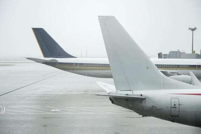
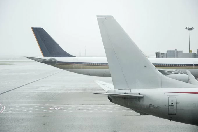
وفي قطاع الطيران، أظهرت بيانات شركة المطارات البرتغالية إلغاء 222 رحلة مغادرة ووصول في مطاري لشبونة وفارو حتى الساعة 9:20 صباحاً، بينها 208 رحلات في مطار هومبيرتو دلغادو بالعاصمة، و14 رحلة في مطار فارو، في مؤشر على اتساع تأثير العاصفة على حركة السفر.
وامتدت الاضطرابات إلى حركة الملاحة البحرية، إذ أغلقت السلطات 18 منفذاً بحرياً أمام الملاحة، وفرضت قيوداً على عدد آخر، بعدما حذرت البحرية البرتغالية من أمواج قد يصل ارتفاعها إلى 10 أمتار، مع احتمال بلوغ سرعة هبات الرياح مستويات مرتفعة في المناطق الساحلية المكشوفة.
وكانت جزيرة ماديرا من أولى المناطق التي تعرضت لتأثير المنخفض الجوي، حيث سجلت أجهزة الحماية المدنية أكثر من 200 حالة طوارئ خلال الساعات الأولى من مروره، معظمها بسبب الفيضانات وسقوط الأشجار، كما ألغيت رحلات سفن سياحية وخدمات النقل البحري بين ماديرا وجزيرة بورتو سانتو.
وفي تطور لافت، عدّل المعهد البرتغالي للبحر والغلاف الجوي توقعاته بشأن مسار «تشارلز» وشدتها، بعدما انقسم المنخفض الجوي إلى مركزين منفصلين للضغط المنخفض، ما أدى إلى تراجع قوة الرياح المتوقعة مقارنة بالتقديرات السابقة، لكنه لم يبدد المخاوف من الأمطار الغزيرة والمستمرة.
وتحولت بؤرة التأثير المتوقع من منطقة لشبونة إلى مناطق ألينتيخو والغارف في جنوب البلاد، بحسب قائد هيئة الحماية المدنية الوطنية ماريو سيلفستري، الذي أوضح أن التوقعات تشير إلى تراجع نسبي في حجم التأثير على العاصمة، مقابل زيادة المخاطر في المناطق الجنوبية.
وكانت الحكومة البرتغالية قد أعلنت حالة التأهب في كامل البر الرئيسي للبلاد لمدة 24 ساعة، اعتباراً من منتصف ليل (الثلاثاء) وحتى نهاية (الأربعاء)، وقررت إغلاق المدارس والخدمات الحكومية غير الأساسية، إلى جانب تعليق الأنشطة الخارجية وإغلاق الحدائق والغابات والمناطق التي تشكل خطراً على السكان.
ودعت السلطات المواطنين إلى البقاء في منازلهم وتجنب التنقلات غير الضرورية، فيما حذرت هيئة الأرصاد من استمرار الأمطار الغزيرة في عدد من المناطق، وما قد تسببه من فيضانات مفاجئة وارتفاع منسوب الأنهار وانزلاقات أرضية واضطرابات في شبكات الكهرباء والاتصالات.
وتأتي هذه الإجراءات في أعقاب تعرض البرتغال لعواصف قوية خلال العام الحالي، أبرزها العاصفة «كريستين» في يناير الماضي، التي تسببت في أضرار واسعة بالمباني والبنية التحتية وسقوط آلاف الأشجار، ما دفع السلطات إلى تشديد التدابير الوقائية تحسباً لتكرار الخسائر.
The storm “Charles” has moved into the phase of actual impact in Portugal today (Wednesday), after causing hundreds of reports of flooding and fallen trees, and the cancellation of more than 220 flights, amid ongoing warnings of heavy rain and disruptions in transportation.
The Portuguese civil protection agency announced the registration of 538 weather-related emergency cases between midnight and 12 PM local time, including flooding, fallen trees, and landslides, while no reports of injuries or serious incidents had been reported by that time.
In the aviation sector, data from the Portuguese airports company showed the cancellation of 222 departing and arriving flights at Lisbon and Faro airports by 9:20 AM, including 208 flights at Humberto Delgado Airport in the capital and 14 flights at Faro Airport, indicating the widening impact of the storm on travel.
The disruptions extended to maritime navigation, as authorities closed 18 maritime ports to navigation and imposed restrictions on several others, after the Portuguese navy warned of waves that could reach heights of 10 meters, with the possibility of wind gusts reaching high levels in exposed coastal areas.
The island of Madeira was one of the first areas to be affected by the low-pressure system, where civil protection agencies recorded more than 200 emergency cases during the early hours of its passage, most of them due to flooding and fallen trees. Additionally, cruise ship trips and maritime transport services between Madeira and Porto Santo Island were canceled.
In a notable development, the Portuguese Institute of Sea and Atmosphere revised its forecasts regarding the path and intensity of “Charles,” after the low-pressure system split into two separate centers of low pressure, leading to a decrease in the expected wind strength compared to previous estimates, but it did not dispel concerns about the ongoing heavy rain.
The focus of the expected impact shifted from the Lisbon area to the Alentejo and Algarve regions in the south of the country, according to the head of the National Civil Protection Agency, Mario Silvestre, who explained that forecasts indicate a relative decrease in the size of the impact on the capital, compared to an increase in risks in the southern regions.
The Portuguese government had declared a state of alert across the entire mainland for 24 hours, starting from midnight (Tuesday) until the end of (Wednesday), and decided to close schools and non-essential government services, along with suspending outdoor activities and closing parks, forests, and areas that pose a danger to the population.
Authorities urged citizens to stay at home and avoid unnecessary travel, while the meteorological agency warned of the continuation of heavy rains in several areas, which could cause flash floods, rising river levels, landslides, and disruptions in electricity and communication networks.
These measures come in the wake of Portugal experiencing severe storms this year, most notably the storm “Kristin” last January, which caused extensive damage to buildings and infrastructure and the falling of thousands of trees, prompting authorities to tighten preventive measures in anticipation of a repeat of the losses.